- Travel + Photos
- Voyages
- New Zealand
Twenty Days in New Zealand

Of New Zealand, I did not know much, except for the All Blacks, its victories in the America's Cup, that it is the paradise for the outdoor enthusiasts, and lastly, that it is home to the Middle Earth thanks to The Lord of the Rings movie. In 2002, I considered moving to live in New Zealand, but circumstances have decided otherwise. This year (2006), I have finally decided to make a visit to New Zealand. One of my cousins came along on this trip.
Day 1 & 2 : Auckland
Our flight arrives in Auckland around 6:30 in the morning on Friday, but the time it takes to pass the customs and to do the paper work for the rental car, we get out of the airport only around 9:30. This marks the first time I drive a car with the steering wheel on the right side; things seem already interesting (see Amusing Facts). After swinging by the hotel to drop our luggage, we head out to Central Auckland.
 The famous Sky Tower, which is almost impossible to miss, dominates the cityscape of Central Auckland. It is there that most of the high-rise office and shopping buildings are located. The streets are somewhat empty around 11 AM, but get quickly crowded in the afternoon. At some intersections, all lights are red at the same time, allowing pedestrians to cross from all four sides and in diagonal as well. It is quite disturbing at first, but that system reveals very practical once you get used to it. This light system is used in all big cities in New Zealand (but not at every intersection).
The cafés are a little everywhere in New Zealand. They are not the same establishments as in Europe. The café in New Zealand is a restaurant that is open from early morning for breakfast, until late in the evening for supper. Its menu is not as sophisticated as in a standard restaurant, but it is mostly as good and cheaper. Of course, the principal drink served there is coffee. It is in a café next to the Harbour that we have our first lunch in New Zealand.
Auckland has many open parks and a beautiful waterfront. To appreciate the greenery, one can take a stroll in Albert Park, Auckland Domain (where is located the Auckland Museum, probably the best of the country) or yet Mount Eden, where one can have an aerial view of the city and of the bay. The waterfront can be best appreciated by walking the 7.5 km (4.7 miles) of the Mission Bay Walk (or part of it) that goes from Auckland Waterfront to Mission Bay.
Auckland has earned its name of the City of Sails from its strong nautical tradition, which can be seen through its marinas. The strong sailing tradition is particularly present at the America's Cup Village; that is where the crew of New Zealand Team was received as heroes after its victory in 1995, the first victory of New Zealand in the America's Cup.
Besides the parks, my favourite area is Parnell. I like it not for its upscale shopping boutiques, but for its dynamic atmosphere and its numerous restaurants. Particularly La Porchetta, a budget price pizzeria that makes very good pizzas (no doubt the best on this trip). The line to get in can be long on the weekend evenings.
Day 3 : Bay of Islands
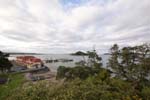 Whangarei is the largest city of the Northland (territories north of Auckland), but on this Sunday, the city centre is empty. We find a café open for lunch (in fact, the only one open in town) and start the conversation with our waiter. Apparently, he loves fishing (a popular activity in the region). He tries to convince us to go buy used fishing rods in order to do sea fishing from shore, where one can catch red snappers (among a variety of fishes that I cannot remember the names) and even sharks. But we politely decline and ask him for tips on scenic places to visit.
After a short visit to Whangarei Fall, a 20-metre fall (65 ft) just outside of town, we take the back roads to the coast of Tutukaka. The coastline is beautiful but it is hard to take any pictures because, the roads being narrow, there is not enough room to safely stop for pictures.
From Tutukaka, there are two ways to continue on to the Bay of Islands: taking the small windy roads to Russell (that are dirt or gravel roads in places), or taking the SH1 (State Highway 1) to Paihia. According to some locals we meet on the road, Russell is more charming and rustic, and Paihia offers more options for lodging. To be sure to find a place to stay, we opt for Paihia, the main tourist town in the Bay of Islands.
The Bay of Islands takes its name from the numerous islands in the bay. To really appreciate it, one should spend at least one full day there. A guided boat tour is probably the best way to see the entire bay and its islands. Some hikes on the Russell side of the bay may lead to some aerial views of the bay. That night, we had a choice between staying the next day in the bay or heading north to Cape Reinga.
Day 4 : Cape Reinga
 Early in the morning, we decide to visit Cape Reinga. But before leaving, we buy some pastries for breakfast at The Pastry (probably the best pastry of our whole trip) and I get coffee at a small local shop owned by an old man (also one of the best coffee I had on the trip).
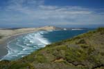
Cape Reinga, along with the Ninety Mile Beach, is the main attraction of the Far North. The Ninety Mile Beach is in reality only 90 km long, but "Ninety Kilometre Beach" or "56 Mile Beach" sure does not sound as poetic. One can drive on that long beach, however, rental cars are not allowed to go there.
Cape Reinga is neither the furthest north point of New Zealand or the east most point of the North Island, but it is the most visited place of the Far North thanks to its light house and the Maori religious believes attached to the place. Sitting there, one cannot help to have that feeling of being at the end of the world. It is then easy to understand why the place is sacred to the Maoris. It is better to get there early if you want to be somewhat alone, as the tour buses start to dump people around noon. Most of the people stay there only for just over half an hour, and it is a shame because there are a number of nice hikes around there, particularly one going from Cape Reinga to the Ninety Mile Beach, passing through beautiful landscapes.
It took us about three hours to drive from Paihia to Cape Reinga, and about six hours from there back to Auckland. Although it does not seem that far on the map, the road going there is slow driving, especially the last 20 kilometres (12.5 mi) that are on gravel road.
Day 5: In Search of Hobbiton
 Instead of following the classic touristy circuit by visiting the glowing worm caves in Waitomo before going to Rotorua, we decide to go look for Hobbiton somewhere around the town of Matamata. Finding the place and seeing its landscape were more interesting to us than touring the movie set, which by the way, can only be visited with a guided tour.
Arriving to Matamata, we were lucky to find a lady willing to give us the general directions to get to the place (none of the other locals we talked to wanted to tell us where). Following her directions, we get to a place where there are only private farms, each enclosed by fences. Looking at the landscape of one of the farms, I suspect it is there they filmed Hobitton, but without seeing the houses embedded into the hills, we cannot be certain. Since the landscape is interesting, I decide to photograph the rolling hills and the sheep. It is then that a van comes by and stops at the gate. The driver gets out and opens the gate. Then the bus enters the farm. Looking closely, the van turns out to be the tour bus; we are on the land of Hobitton!
Arriving in Rotorua, we check in at Geneva Motor Lodge, a motel that Susan, a waitress at Dunk Café in Auckland, had highly recommended. We intended to spent the next day in Rotorua then do the Tongariro Crossing the following day, but Sheryll, the owner of Geneva, tells us that weather-wise, tomorrow is the best day for the crossing. We then decide to leave and Sheryll agrees to let us check out (with no charge) with the promise of returning to stay at her motel afterwards. She even helps us book a room in Lake Taupo and arrange the shuttle services for the Tongariro Crossing.
Day 6 : Tongariro Crossing
The shuttle bus from Tongariro Expeditions picks us up outside of our motel in Taupo around 6:20 AM. After picking up everybody and the hour or so drive, we get to the Tongariro National Park around 8:30 AM.
The Tongariro Crossing, a 17 km (10.5 mi) tramping across the national park, is one of the Great Walks in New Zeland. We start from Mangatepopo car park (1150 m, 3773 ft) and finish at Ketetahi car park (700 m, 2296 ft). The trek starts with an easy walk up to Soda Springs. Contrary to most people, we make the little detour to see the small Soda Springs waterfall.
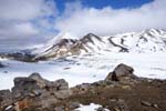 The section between Soda Springs and the South Crater is the most difficult on this trek. The locals do not call it the "Devil's Staircase" for no reason; in some places, I have to use all of my "four legs" to scramble over basalts boulders. Once reaching the top of the Devil's Staircase, those who have found it easy (not me) can do a side trip up Mount Ngauruhoe, a tough 2-3 hours climb for an exhilarating 15 minutes descent.
The South Crater is flat and still covered with ice and snow on this day. Once crossed the crater, the trail goes along an exposed ridge up to Red Crater (1886 m, 6187 ft). As indicated by its name, the Red Crater is characterized by its dark red and charcoal colour. At the rim of the crater, one can smell the odour of sulphur and feel the heat from the smoke. That warmth neutralizes the cold wind on this day, making the crater's rim a good place to stop for lunch and to rest.
Descending from the Red Crater towards Emerald Lakes, I meet some New Zealanders from the South Island who are tramping in the opposite direction, taking 2-3 days and making side hikes. They inform me that it was very cold the previous day with thick fog and strong wind. It turns out we are quite lucky to do the crossing in good weather and be able to see that wonderful landscape. With the sun, the snow, a beautiful view of the lakes and the warmth (when sheltered from the wind), one can imagine being on a white sand oasis somewhere.
From there, the trail descends to Ketetahi Hut (where one can stay overnight), then into the forest before coming out at Ketetahi car park. Once passed the Ketetahi Hut, the view is not as interesting. After a trekking day like today, climbing up the three steps onto the bus has never seemed so difficult. That night, in Rotorua, it feels so good to be able to relax in the spa at the hotel!
Day 7 : Rotorua
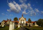 After a long day yesterday, we wake up later this morning and decide to take it easy. Rotorua is well known for its thermal activities, so we decide to visit Te Puia, one of the two thermal parks of the town. One of the main attractions of Te Puia is the Pohuhu Geyser, one of the biggest geysers in the region. It erupts in an average of once every hour, lasts for more than twenty minutes at a time, and can reach thirty metres (99 feet) in height. While sitting on the rocks to watch the eruption of the geyser, I realize that they are naturally heated by the geyser and thus provide some warmth in this cool morning. In fact, it feels good lying on those rocks; it warms the back and relaxes the muscle. Now, if only there could be a bit of vibration to provide some massages! Relaxed, I try to wait until the end of the eruption, but after more than twenty minutes, I get bored and move on.
Note that the gift store inside Te Puia has numerous Maori mask and statues of good quality and at reasonable prices. In my mind, the masks and statues here are more interesting and of better quality than those I saw elsewhere in New Zealand.
In the afternoon, we make a tour of the lakes around Rotorua (there are many) and stroll the city centre. In the evening, we visit the thermal pools at the Polynesian Spa. Its Radium and Priest Springs, which are reserved to adults only, have four pools of mineral water of temperature going from 39 to 42ºC (102-108ºF). We are now well relaxed and rested to continue on our trip.
Day 8 & 9 : Wellington
We head directly to Wellington from Rotorua, going through Desert Road (the portion of the SH1 passing by Tongariro National Park). The view from the Desert Road is spectacular, but keep your eyes on the road, as it is windy. From there, one can have a good view of Mount Ruapehu, also known as Mount Doom in The Lord of the Rings. At 2797 metres (9176 ft), it is the highest peak of the North Island.
Sheryll, the owner of Geneva Motor Lodge in Rotorua, had found a good deal for us and booked us a room at the James Cook Hotel Grand Chancellor, right in the heart of Wellington. The hotel is a bit luxurious for me, but its location and its private underground parking make staying there very practical. Friday night seems to be very animated in Wellington centre; a lot of young people hang out in restaurants and bars of big hotels. There is an abundance of café and restaurants of all sorts of cuisines on Cuba Street. Very animated on Friday night, the street is mostly empty on Saturday morning, and only starts to fill up around noon or so.
 The Parliament, the main architectural attraction of the city, is composed of buildings of completely different styles. The Beehive is a building of modern architecture from the seventies that hosts, among others, the Prime Minister's office. Next to it is the Parliament House of a baroque style, and the Parliament Library of a gothic Victorian style. Those buildings as a whole form a unique visual effect.
Wellington's harbour is not pretty. Whereas Auckland Harbour has nice marinas, this one is a mundane industrial port. The view gets a little nicer towards Orient Bay.
Our ferry for the South Island leaves at 2 PM. It is very windy during the three hours crossing, with wind gusts of more than 100 km (60 mi) per hour, which makes taking pictures an interesting (read tricky) task. Once on the South Island, we head to Nelson directly. Since this is a holiday weekend (we are Saturday and Monday is Memorial day), most of the hotels are full; but we end up finding a room. Whew!
Day 10 : Sea Kayaking
The shuttle bus for Abel Tasman National Park leaves from Nelson before 7 AM. It rains cats and dogs this morning and the rain lasts all day long, even though the forecast called for some sun breaks in the afternoon. The bus driver tells us that the forecast centre has given up forecasting in the area as the weather there is so unpredictable.
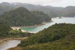 We take an all day sea kayaking tour with ATK (Abel Tasman Kayaks), which provides the gear, the water taxi, lunch and the guide. Ordinary, the sea is very calm and the water very clear, but not on this day. The wind is constant and relatively strong, making waves of more than one metre (4+ feet, which is big for this sea that usually sees no wave). Since most of the people in our group have no kayaking experience, Kate, our guide, decides to stay close to shore. The landscape is beautiful despite the rain and the grey skies. It rains so much that I do not even want to risk using my photographic camera. (Thus I have no picture of calm and transparent water to show you.)
At the end of the day, we do a little walk on the hills of Torrent Bay. Kate explains the flora of the region and shows us some nice views of the bay. Once back to ATK's headquarters, I relax in their hot tub for a little while, before taking the shuttle bus back to Nelson.
Day 11 : The West Coast
We were hoping that it would stop raining today so we can do some hiking around Abel Tasman National Park, but the weather has decided otherwise. So we head down to Fox Glacier. On the way down, we make a little detour to Nelson Lakes National Park to see Lake Rotoroa. As soon as we get out of the car, we are greeted by an army of mosquitoes! The lake is still covered by morning fogs, so we leave after a short walk.
The West Coast is characterized by mountain chains on one side and the Tasman Sea on the other, which produce beautiful landscape with cliffs and big waves. We arrive to the West Coast at Westport, and head straight down for Fox Glacier. On the way, we pass by Franz Joseph Glacier, which seems to be touristier than Fox Glacier.
Day 12 : Fox Glacier
In contrast to the previous evening where a thick layer of clouds covered the mountains, the sky is clear this morning and the sun announces a perfect day for climbing the glacier. We take an All Day Fox Glacier Walk with Fox Glacier Guiding, the sole guiding company at Fox Glacier.
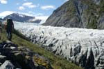 With its 13 km (8 mi) long, Fox Glacier is the longest glacier on the West Coast. What is disconcerting (to me) is being on a glacier and seeing lush rainforest in the surroundings. (Franz Joseph Glacier, 25 km (16 mi) further north, shares the same surprising characteristic.) That is possible thanks to the very steep slop of the glacier (it drops over 2600 m, 8530 ft) that allows the river of ice to move approximately 10 times faster than other valley glaciers in the world, at an average speed of more than one metre per day. Another surprising fact: Fox Glacier is advancing (anew) since 2004, whereas most other glaciers are retreating due to global warming.
The ascent starts on the side of the glacier through the rainforest. Certain passages are precarious because of the cliffs. Others are dangerous because of loose boulders (it has rained a lot the few previous weeks). At one place, the guides have put an electric wire around a loose boulder and connect it to a LED on the trail below. If the boulder starts to fall, its movement would disconnect the wire and turn off the LED, thus alerting us of the falling danger. We cross in hurry four at a time, while the guide has his eyes fixed on the LED. After 40 minutes of ascent through the forest, we arrive to the side of the glacier. After putting on crampons, we start the proper ascent of the glacier.
I would have liked to see caves and tunnels carved out of the ice by the rain and melted water, but being only early spring, there is none. At the end of the day, while descending the glacier, we can hear booms and bangs like explosions; the noises are from blocks of ice crumbling under the heat of a sunny day.
After the day hike on Fox Glacier, I head to Lake Matheson to take pictures of the lake with mounts Tasman and Aoraki/Cook in the background. Lake Matheson is probably the most photographed lake in New Zealand (and I did my best to contribute to the statistics). I stay there for a long time hoping that the clouds would completely clear from the mountains' peaks, but after two hours of wait and with the sun going down and the cold that comes with it, I loose hope and leave. It turned out that I left about 10 minutes too early, because when I got back to the parking lot, the peaks are cleared and show off their beautiful cerise colour.
Day 13 : The Road
After having breakfast at Peak View Point (on the way to Gillespies Beach) and watching the mountains bathing in the morning sun, we head south for Queenstown. On the way there, we linger around lakes Wanaka and Hawea in order to admire the landscape. With such nice views, it is not surprising that these lakes are a popular destination with the Kiwis for summer vacation. We stop at the little town of Lake Hawea (on the border of lake Hawea, duh!) and have lunch at Lake Hawea Lunch with View restaurant (no kidding, it's the name on their menu).
Once we arrive at Queenstown, we go directly to the visitor centre to check on the weather at Milford Sound; it seems that it will rain there in a couple of days (it rains a lot and often at Milford Sound). We were told that the fjord is very beautiful even in rainy weather. Sure, but why not trying to visit it on a sunny day? We decide then to visit Milford Sound the next day, hoping to be there ahead of the rain. A Milford Sound visit can be a day trip from Queenstown (and a lot tours do it), but the long drive (more than 5 hours) makes it a long day. It is better to make the visit from Te Anau; so we leave Queenstown for Te Anau.
Day 14 : Milford Sound
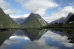 The morning comes with sunshine. We leave early, content from having made the right choice the day before. The road leading to Milford Sound is very scenic, but to have some tranquillity, it is better to go early in the morning or late in the afternoon, as there can be a large number of tour buses on the road (there could be up to 70 buses per day in the summer). The Milford Road climbs to a pass of more than 900 m (2950 ft) (the surrounding peaks are still covered in snow on this day) before descending to the fjord.
The best way to visit the fjord is probably by cruise boats, specially the smaller ones, as they can get closer to the cliffs. We did our tour on the Encounter Nature Cruise from Red Boat Cruises. The wind is quite strong and cold today, which makes staying too long outside a little uncomfortable. Fortunately, the complementary coffee and tea on board do help warming up. Another way to stay warm is to have a chat with the captain in his command centre (it is allowed and even encouraged). He knows well the area and has plenty of stories to tell, you just need to ask him.
One of the specialties of this cruise is to go right underneath waterfalls, allowing those who want to fill up their glass (provided by the crew) with mineral water and drink it. Despite the cold, a lot of people do it.
Towards then end of the cruise, menacing dark clouds start to move in. In a little more than half an hour, the sky is completely covered. The pass on Milford Road is now in the fog. The rain starts to fall. Since I want to take pictures on the way back to Queenstown, and since we have already spent a lot of time on the road the day before, we decide to spend another night in Te Anau and take a stroll on the lake of the same name.
Day 15 : Queenstown
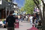 Queenstown, a city on the border of Lake Wakatipu, in the south of the South Island, is known as the world capital of adventurous activities. Indeed, there are a lot of activities such as bungee jumping, whitewater kayaking, rafting, skiing etc. The town is very dynamic, with a lot of young people. The streets are animated, and shops and restaurants are everywhere. At lunch, we take a strategically placed table on the terrace (first floor) of a restaurant in order to enjoy the view of Queenstown Mall and the nice weather.
We are told that there are two places where we can have an aerial view of the town: Bob's Peak (at the top of the gondola) and Queenstown Hill. The waitress at the restaurant told us that the gondola is free for coming down, so we figure that we can hike up to Bob's Peak, take the gondola down and still have time to hike Queenstown Hill. We soon discover that the trail up to Bob's Peak from the bottom of the gondola is closed (and the descend on the gondola is no longer free). So we head for the summit of Queenstown Hill. From the lake, one can drive up half way to Queenstown Hill, but having left our car at the motel (which is located on the outskirt of town, at 13 minutes walk from the city centre), we hike all the way to the summit from the lake. The slope is steep, which makes the view from up there more gratifying and spectacular.
Before this trip, I saw a picture of a very interesting place that makes me want to visit (the photo's legend says the Church of the Good Shepherd on Lake Tekapo). The previous day, thanks to my cousin who was looking at a postcard of that place, I discovered that it is the Pancake Rocks at Punakaiki on the West Coast, where we have passed by earlier in the week! Since I really want to visit that place, we decide to shorten our stay in Queenstown so we would have time to go back to Punakaiki. It is actually not a bad plan, as it allows us to see Arthur's Pass at the same time.
Day 16 : The East Coast
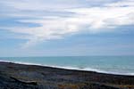 We leave Queenstown early for Moeraki on the East Coast. The Moeraki Boulders are stones naturally spherical of one to two metres (3-6 feet) in diameter (it is said that the first European settlers took all of the smaller size ones). They are spread on the beach like marbles of giants (the view is better at low tide). A little further north, we stop in Hampden for lunch at the famous Fish and Chips Take-away, which is apparently internationally renowned. I must admit that their famous blue code is very tasty (and inexpensive as well).
From there we head north along the coast on SH1 up to Timaru. In general, I find that the East Coast is not as picturesque as the West Coast, at least on the section that we have seen. There is practically no wave and no mountain to contrast with the ocean. Also, the ocean seems to be colder. Since the road is rather flat and straight, we get to Timaru much earlier than we expected. Instead of spending the night there, we decide to continue on to Springfield, taking the Inland Scenic Route 72, in order to be closer to Arthur's Pass.
In Springfield, we dine at Yummy Homemade Food café, owned by Joy and her husband. Joy seems to be a character coming straight out from Greenwich Village rather than someone from a small town at the foot of the mountains. That impression is reinforced by her choices of music: jazz, latin and brazilian. After chatting with her, I learn that she is indeed New Zealander and not a New Yorker, and that he has extensively travelled in her youth (among others, she has lived in Australia for a while). As indicated by its name, she insists on the fact that the food at her restaurant is 100% homemade and that 80% of her clientele is local.
Day 17 : Hokitika & Pancake Rocks
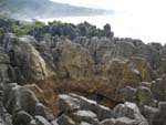 "What are you doing today?", asks the owner of the youth hostel where we have spent the night. "A little hiking in Arthur's Pass National Park, before going back to the West Coast", I reply. "Today is a driving day", he retorts with a smile. Indeed! Although it does not rain this morning in Springfield, torrential rain falls on Arthur's Pass. It has so much rained (since the night before) that the rivers are muddy and at near flood stage. The road going through Arthur's Pass is steep, very narrow and very windy. Driving on that road has now become even more difficult because of the blinding rain and numerous falling rocks; not only it is difficult to see (it is almost dark, even though we are in the middle of the day), but one must also avoid the rocks often blindly hidden in tight curves.
It still rains strongly when we arrive on the West Coast. In order to kill time before coming back to the Pancake Rocks at high tide (around 4:30 PM on this day), we head to the town of Hokitika. This charming small town is known for its crafts, in particular those in jade (I learned that from a guidebook), and for its Wild Food Festival which takes place on the second weekend of March (I saw that on TV and would have liked to attend). And while we are there, we shop around for some gifts.
The 35 million-year old Pancake Rocks are the product of waves pounding the soft limestone and mudstone cliffs into strange formation of superposed pancakes. In two places, subterranean channels have been carved out; when water surges, it shoots high into the air, creating the blowholes. This amazing phenomenon is best observed at high tide or when a big storm comes in. We get there a little after 5 PM, when the tide is still high and the rain seems to stop. I just have time to take a couple of pictures when a heavy shower hits us anew. Having waterproof gear from head to toes and a big plastic bag to protect my photographic gear, I was able to stay a little longer to take pictures of the Blowholes in action.
Day 18 : Arthur's Pass
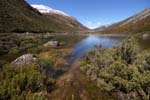 It is amazing how different Arthur's Pass can be on a sunny day. The snowcap mountains of the Southern Alps make the landscape spectacular. Even though the road remains narrow and windy, it does not seem as dangerous as the previous day (the fallen rocks have been removed; decidedly those Kiwis work real fast). We stop at several places to admire the views and for short hikes. Twice, the keas (native mountain parrots from New Zealand) come close to our car to see us; they are definitely not afraid of human, those parrots.
Not far from Springfield, we stop at Castle Hill to explore the strange formation of limestone boulders. Those big boulders "grow" on the hills; some take very interesting forms, creating some kind of lunar landscape. The Maoris ask people not to rock climb there to respect the sacred status of the place.
Day 19 & 20 : Christchurch and Akaroa
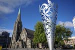 Christchurch, located on the East Coast, is the biggest city of the South Island. It has a certain English charm with its many gardens, public parks and the Avon river. We start our visit with The Christchurch Botanic Gardens, then the Canterbury Museum, which is right next to the botanic gardens. From there, we walk up Worcester Boulevard to Christchurch Cathedral, visiting The Art Centre and Christchurch Art Gallery on the way there. The manager of the motel where we stayed the first night told us that the city is small enough it could be visited in three hours; we took the whole day to explore it.
On the last day, we visit Akaroa, a small town on the Bank Peninsula at a little more than an hour drive from Christchurch. The town was founded by French settlers in the middle of the 19th century, but the only French influence left is in the names of streets and cafés. For me, the most interesting part of the visit is the view on the bays from the hills high up. Once back to Christchurch in the afternoon, we still have time to stroll on the beach and watch surfers before heading to the airport to head home.
Amusing Facts
Driving
Even though I have driven in England, I have never driven a car with the steering wheel on the right. This visit to New Zealand marks the first time that I do so. I wanted to hire a manual transmission car so that I can experience shifting gears with the left hand. Since the placement of the clutch, brake and acceleration pedals does not change (from left to right in that order), I only have to worry about the gear shifter. The gear grid does not change either (first gear is up left, second gear is down left etc.), but since you sit on the right, you engage the first gear by pushing the shifter away to the left instead of pulling it closer to you. Changing gear reminds me of the time I learned to drive: I have to think about the position of the shifter on the grid. But soon enough, I get used to shifting gears with the left hand and no longer need to think about it.
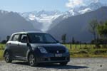 When I drove in England, I had to concentrate hard to stay on the left lane, especially when I get to an intersection at night with no one in front to follow. With the steering wheel on the right, stay on the left lane seems quite natural and I don't have to think too much about it.
On the other hand, I had some hard time with the reverse control sticks: the windshield wipers lever is on the left, and the blinker is on the right. So that by instinct, I turn on the windshield wipers when I want to make a turn, and set the blinkers when I want to wipe the windshield! After a few days, I start to get used to activating the correct control. But my old reflexes would take over time to time (especially when I am tired and my left hand is on the steering wheel, strategically placed by the control lever) and I activate the wrong control almost once a day. Once back home, things are a little confused the first couple of days before my old automatism takes over again.
I am often surprised to see young kids, 13 and younger, drive in New Zealand, before remembering that the driver actually sits on the other side (right) and that those kids are only passengers.
The South Hemisphere
Since this trip is the first time I ever went to the South Hemisphere, I wanted to verify one fact. So, one of the first things I did upon arriving to New Zealand is to flush the toilette to see whether the water really drains in the opposite direction than on the North Hemisphere.
Hunters
When we arrive at Fox Glacier, we go to the information centre to ask about lodging and hiking the glacier. As usual, I carry my photo gear in a yellow waterproof Pelican case. A guy asks me if I have a riffle inside the case. I realize quickly that he is not joking and tell him that it is just my camera and lenses (but he does not seem to believe me).
The next day, during the glacier walk, our guide tells us stories on Fox Glacier, particularly one on hunting. Apparently there is no hunting season there; one is allowed to hunt year round. Therefore, a good number of rich Americans come there just for hunting. They hunt from a helicopter that takes them to the mountain to only yards away from their prey, so they can shoot. Those hunters come with their own riffle that they carry in a hard case. There, I understood that I was mistaken for one of those rich hunters (doubly wrong)!
Practical Details
Dates of my trip: 11 Oct - 1 Nov 2006 (arriving in Auckland on 13 Oct)
Tipping is not widely practised in New Zealand. A few restaurants have a tip jar, but I did not see anyone putting money in those jars.
It is common to pay at the counter in most restaurants, even in some nicer ones. In some restaurants, you are expected to bring your bill to the cashier, in others, it is up to you to either pay at the table or at the counter.
It is very easy to get money from the ATM in New Zealand with your foreign bankcard. The Cirrus and Plus networks are widely present, and there is always an ATM in all of the cities we have been to. As a matter of fact, I did not buy any New Zealand dollars before going and just took the money out from the ATMs once I was there.
Links
- i-SITE
- Visitor Information Centres in New Zealand. These i-SITE centres provide free maps and can also make room reservations.
- Route Guide: Tongariro Crossing
- A guide of the Tongariro Crossing with detailed descriptions of the trail.
- Geneva Motor Lodge
- Our hotel at Rotorua. Sheryll provides exceptional services, nothing short of 5 stars hotels.
- Abel Tasman Kayaks
- Provides guided sea kayaking tours at Abel Tasman National Park.
- Fox Glacier Guiding
- The sole guiding company at Fox Glacier.
Copyright © 2007, Northwest Summit. All rights reserved.
No part of this page may be reproduced, republished or copied without the
express written permission of its author.